Toc
- Introduction
- Examples
- News
The Space Data Wiki concept is actually very simple. Images and/or other data of planetary surfaces, and other objects of exploration in the cosmos are served using a Web Map Server system. A user can can add a marker or region that is then linked to a Mediawiki page for that marker or region. This allows exploration and observations to be shared collectively. An unrelated project of mine, created using QGIS, shows an example of this functionality. Another project that is an example of this kind of functionality is "Fix My Street".
The approach is not only useful for scientific exploration but could be used for mining surveying. Modern spatial databases also have the ability to store data in the third dimension which could be used to allow observations to be recorded in a 3D space such as caves or the 3D structure of Nebulae.
Some of markers might include the following.
- We think we have detected interesting signals coming from this star. Please add any relevant information to the page.
- This region of space appears to match with our hypothesis. Follow the link through the region (highlight with mouse or touch) to the page that lists all the relevant research and observations.
- This object on Mars is interesting. Follow the link on the marker to the wiki page for it.
- This region/marker is another example of our known/hypothesised Mars geology process.
The project is currently focussing on working with Mars HiRISE images and has code on GitHub.
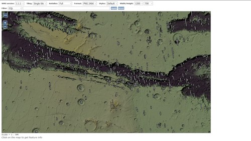
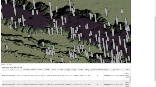
- 19th Dec 2016 - Setting up a Mars base map in Geoserver. The shaded and slope shaded map is created from MOLA data. The seperate layers were created from the MOLA data usig GDAL. But Geoserver is dynamically adding the layers together and creating the colour ramp. This is a preview OpenLayers created by Geoserver. The server returns all HiRise footprints at a given clicked location as can be seen in the second image. The footprints are help in a PostGis database created from the original NASA/HiRise Shapefile. The entire map is published in the official IAU (International Astronomical Union) Mars projection Mars 2000 49900. This WMS not publicly available yet as it is not fully tiled.


